Sattler included a category where he listed those publishers/ engravers who had tried something different. The original list was limited to just entries D.2. and D.3. below, however I feel that the other works also deserve a mention somewhere and that this is a good place for them to be included. They are not all strictly Rhine panoramas which is why Sattler dealt with them separately. The two that he selected attempted to combine "map, illustration and text". The other examples below attempted new methods to portray the river in all its glory.
D. 1. Friedrich Carl Vogel 1833
D. 2.
Ravenstein - Die Rheinlande 1837
D. 3. Ritter 1842
D. 4 A H Payne 1844
D. 5.
Scheuren 1872
D. 6 . Frey 1865
D. 6 . Frey 1865
Also of note here are two unusual works.
D. 7 Das
Rheintal von Bingen bis zum Lurley - Guckkastenbild / 3D view
D. 1.
Vogel 1833
Das
Vogelsche Riesenpanorama - Vogel's Giant Panorama
F. C. Vogel's
Panorama des Rheins oder Ansichten des rechten und linken Rheinufers von Mainz
bis Coblenz. Das rechte Rheinufer nach der Natur gezeichnet von J. F. Dielmann,
auf Stein gezeichnet von A. Fay. Das linke Rheinufer nach der Natur und auf
Stein gezeichnet von J. Becker. French and English titles parallel.
Publisher's imprint: Frankfurt
am Main: Lithographische Anstalt von F. C. Vogel, [1833].
Lithography comprising a total of 92 plates showing a view of the river in 2 strips (i.e. left and right river banks, each with title/oientation) making a complete length of 20000 x 100
mm.
Kart.
L 17350
This giant panorama was produced in the lithographic workshop of Friedrich Carl
Vogel in Frankfurt am Main. Around 1830 the banks of the Rhine river between Mainz and Coblenz
were recorded by two well-known landscape painters: Jakob Becker (1810‑1872) drew the left bank, while Jakob Fürchtegott Dielmann (1809‑1885) recorded the right bank. In this panorama the banks are seen from a point mid-river, which is shown in extreme detail and is alive with shipping. The approximately 90 km stretch then depicted in 2 long strips measuring a total of twenty meters.
This panorama appeared in a smaller format when it was published by Payne, 1845, see below.
See
Flüsse im Herzen Europas R 53
Sattler, Rheinpanoramen 11A
Vogel's Panorama
Illustration from dilibri - Koblenz : Landesbibliothekszentrum Rheinland-Pfalz, 2007
D. 2. Ravenstein 1837
According to Sattler and Flüsse im Herzen Europas Ravenstein produced three separate maps
concerning the Rhine. The first is this:
Die Rheinlande von
Mannheim bis Köln; in vier Karten. Im Maßstab 1:200000 entworfen von August
Ravenstein. Frankfurt: Friedrich Wilmans 1837.
Four lithographic maps and book text; je 465 x 195 mm. total of 14 vignettes,
9 plans, several specially prepared extra maps and plans.
This early attempt at combining maps, illustrations and text was not very successful. Probably readers felt the sheer amount of information presented detracted from the clarity.
This was, in fact, the first of what was planned to be a series of such works covering the whole of Germany as well as neighbouring states.
However, the only work to subseuently appear a year later was: Die Gegend um Leipzig und Dresden mit der Sächsischen Schweiz und der
Umgegend von Teplitz (6 sheets).
See
Sattler, Rheinpanoramen D9


Detail from Ravenstein
Illustration from University Münster - http://sammlungen.ulb.uni-muenster.de/hd/content/zoom/4111351
D. 3 Ritter 1842
Cover title
Der Rhein von der Quellen in der Schweiz bis zur Mündung in die Nordsee (slipcase title) with Historisch-Topographischer Reise-Atlas mit Plänen und Vignetten. Three line border with floral decoration in corners and halfway along each margin, repeated on reverse (but no titles).
Map title
Title page (with book held
upright) repeats the above title but adds mit
den Abstechern auf der ... followed by a list of eight different rail lines
or shipping lines plus Mit vielen
Städte-Planen und Vignetten. Imprint
added below all: Zweibrücken, 1842. Druck
und Verlag der Ritter'schen Buchdruckerei und Buchhandlung.
This publication was designed as
an atlas with each double page opening out to comprise one section of the
complete journey indicated in the title. The book consists of title page and
XIII Sections starting with Quellen-Chur
and ending Utrecht-Nordsee. Each
section has a map of the section covered centrally and this is flanked by a)
notes on towns and places shown, b) vignettes of views and monuments and c)
plans of the chief towns and cities described.
Apparently the atlas was
published in parts (booklet with four sections; e.g. Der Rhein durch die Rheinpfalz und den Rheingau bis Coeln) and also
complete (i.e. with XIII sections). See Holzhäuser entries 42 and 43 respectively.
Size
Cover (map book with title
horizontal) is 190 x 240 mm. Engaved area of each double page is approx. 345 x
222 mm:
Not in
Flüsse im Herzen Europas
Sattler, Rheinpanoramen D10
Holzhäuer Der Rhein im Panorama 42 and 43 (p. 102)
NOTE: All details (and
assumption concerning entry 42) taken from the facsimile edition published by
Prestel Verlag, Munich, 1976.

Cover to facsimile edition

Map detail (facsimile)
D. 4 A H Payne 1844
A.
H. Payne: Panorama des Rheins
Payne's Panorama of the Rhine. Exhibiting in one continued view, both
banks of the river, from Mayence to Coblentz, the Slebengebirge and Cologne. Engraved from original drawings, in 60 views, on 20 steel plates.
London: Brain and Payne [1840-FiHE]. 20 steel engravings; 300 x 200 mm, each picture strip 270 x 38 mm. 48 pp. Text: The Banks
of the Rhine from Mayence to Cologne.
The english steel engraver Albert Henry Payne copied Friedrich Cart Vogel's inspiration to prepare this view of the banks of the River Rhine from MaInz to Coblenz as three narrow strips per page. In his Leipzig printing business, the "Englischen Kunstanstalt" (English Art Institution), he prepared both the German version as well as an English edition nder the title Panorama
of the Rhine. Exhibiting both Banks of this beautiful River".
(Sattler) The English painter and engraver on steel Albert Henry Payne (London 1812‑1902 Leipzig) established his "Englischen Kunstanstalt" (English Art Institution) in 1839. From 1842 to 1850 he published a periodical „Payne’s Universum“ in eight volumes eac containing 12 issues. )Although Sattler does not expressly state this it seems clear this was a monthly issue, popular in England at the time, and each monthly issue would be bound at the end of the year to form an annual volume.) With each issue came 4 steel engravings. In the third volume of 1844 twenty sheets were printed each having three narrow river views showing the banks of the Rhine. Fifty-eight of these views – 29 for each bank from Mainz to Coblenz – are evidently reduced copies of the same stretches covered by the Vogelschen Panorama. To these were added both a view of Cologne and another of the Siebengebirges.
The actual engraver is not named. The sheets very probably are the work of Payne himself - the art dictionary of Thieme and Bekker quote Payne as being a „reprod, Stahlstecher“ (reproduction engraver) without meaning to be in any way ironic.
In 1845
the twenty plates were then issued separately in book form with accompanying text.
quer‑8°
Kart. 37018/10
See
Flüsse im Herzen Europas R 54
Sattler, Rheinpanoramen 11B


Typical sheet from A H Payne
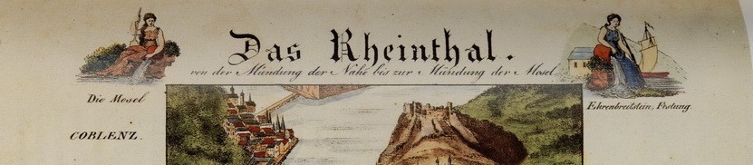
D. 5. Scheuren 1872
Caspar
Scheuren: Vom deutschen Rhein Mit
landschaftlichen und architektonischen Ansichten nebst Illustrationen zu
rheinischen Dichtungen in 25 Blättern von Caspar Scheuren. 2. Aufl. Düsseldorf.
Baumann [1872].
Chromo-llthography;
views and ornamental leaves, 3.5 x 24 cm.
A really beautiful set of views of the Rhine but do
not count as a panorama. Note that at least one of Delkeskamp's publications
was sold in this way: each section of the panorama printed separately on one
sheet of paper and the set sold as an album of sheets.
See Flüsse
im Herzen Europas R 59


D. 6 .
Frey 1865
Another publisher who attempted to show the river in a set of plates rather than a leporello was Philip Frey. In the late 1860s he published a book of the course of the river comprising 16 sections using photographs of a newly drawn and engraved Rhine Panorama including 42 side illustrations and real photographs stuck on front and back covers. There was a 15-page leaflet with text in three columns in English and French as well as German.
The newly completed drawing of the river was photographed and 16 photographs (each 153 x 197 mm) prepared. These were adorned with a title relevant to that stretch of the rier portrayed and stuck into the booklet. This work was probably completed some time after 1864 as the new railway bridge in Coblenz is shown, completed in that year.
Holzhäuer reports that the Jewish publishing house of Philip Frey was established in 1844 in Frankfurt and was one of the first to experiment with the new technology of photolithography. He had one Rhine illustration prepared which he successfully marketed in a variety of forms over the next 30 years or so.
Cover title
Der deutsche Rhein. Führer von Mainz bis Coeln mit Rand
Ansichten – Deutschem, Französischem und Englischem Text – aufgenomen und nach
der Natur gezeichnet von Fritz Neumüller. Imprint Ph. Frey & Co.,
Frankfurt/M.
Map
title
Size
Cover (with title horizontal) is 100 x 145 mm. Map
area is approx. 120 x 1460 mm within border (i.e. full length but 10 mm margins
left and right).
Not in Flüsse im Herzen Europas
See Sattler, Rheinpanoramen
H20, H21 / 9A-9D
Holzhäuer Der Rhein im Panorama 49-54 (p. 105 ff.)
Frey: as illustrated in Holzhaüer p. 105.
No comments:
Post a Comment